_7565.jpg)
Located in Arizona, just outside of Phoenix, is the engaging and deceptively prolific beauty of the Apache Trail Scenic Drive. It’s complex natural sights, rich history, and hiking friendliness make for a wonderfully diverse travel experience.
The Apache Trail's Natural Beauty
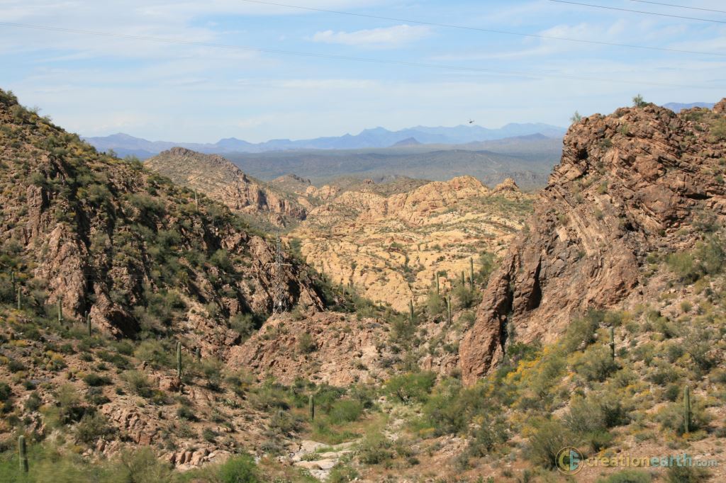
The Apache Trail attracts nature-oriented travelers with its breathtaking natural beauty. It runs through the famous Superstition Mountains and links several spectacular areas. Hence the Trail offers visitors and locals an impressive view of its rugged and pristine beauty.
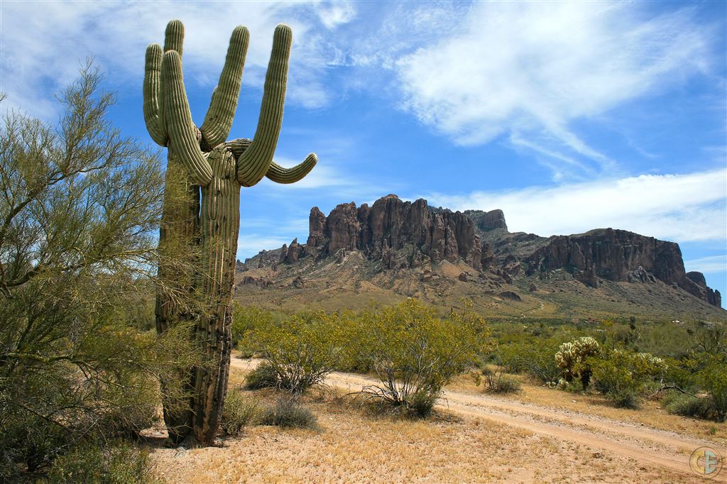 Superstition Mountains
It is quite a long stretch covering about 50 miles. The first 25 miles are paved and make possible an easy drive as visitors get to see the desert plants and trees in their natural environment.
The Apache Trail also features other fantastic attractions. For instance, those using the trail can stop over at Canyon Lake which boasts impressive rock formations on its shoreline. Also, one of the world's tallest masonry dams, the Roosevelt Dam, is at the end of Route 88 while the Roosevelt and Apache Lakes offer you more breathtaking views of Arizona's water bodies.
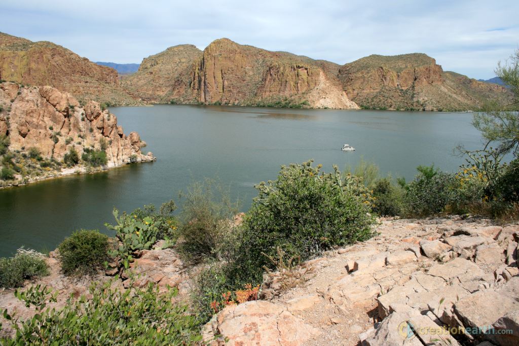 Canyon Lake on the Apache Trail
The Apache Trail One Lane Bridge provides one of the best views of these water bodies. Travelers also get to take a trip a historic trip through several old towns located on the trail such as Goldfield Ghost Town and Tortilla Flats. There are plenty of epic photo opportunities so carry your camera with you.
Hiking on the Apache Trail
Driving on the Apache trail only provides a glimpse of the country’s breathtaking natural beauty. To see it in detail you must venture deeper, off the paved roads. But remember, this is a desert and the deceptively taxing heat can sneak up on you quickly.

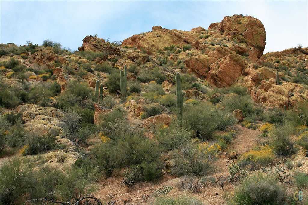
Hiking is done from different points along the trail. For instance, visitors can begin at the Lost Dutchman State Park which is at the base of the Superstition Mountains. It is the ideal starting place because it offers hikers a chance of exploring the majestic Superstition Mountains and numerous hiking and nature trails nearby. You can spend a few days here satisfying your thirst for adventure since there are about 35 campsites and picnic facilities. Other areas such as the Canyon Lake, Goldfield Ghost Town, the Tortilla Flats, Tonto National Monument also offers ideal camping, hiking, and picnic facilities.
History of the Apache Trail
Besides its natural magnetism, the Apache trail boasts a rich history which dates to the 19th century. Its name traces its origin to the Apache Indians who are said to have carved this 43-mile route across the mountains as they migrated. Stagecoaches later adopted it and today it is the rugged traversable terrain people love so much.
Other Indians, known as Salado, also occupied the area once and created many trails which hikers use today. Decades ago the trail was rugged and raw but in 1903 its development progressed so it could facilitate the transportation of the Roosevelt Dam construction supplies from Mesa to Roosevelt Lake.
The trail was officially named the first historical highway in Arizona in February 1987 and was opened to the public. It takes around 6 to 8 hours to finish the entire journey through this serene and scenic 42 miles stretch.